Showing posts with label hiking. Show all posts

Thursday, October 11, 2007

Mount Aire

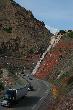
Mount Aire TrailI took Coco on a quick walk up Mount Aire in Mill Creek Canyon. The trail had recently been dusted with snow and was a bit muddy but not impassable. The trail rises 1800 feet in 1.8 miles. It is a favorite of fitness hikers and trail runners since you can get a good workout in a short trail.

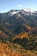
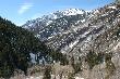
Mill Creek CanyonThe trail offers some sweet views of Mount Raymond and Goblers Knob. The picture to the left is of Goblers Nob. As we had a strong storm a few days back, a good portion of the fall folliage has been blown away, but there was enough to provide a few interesting Fall Leave style shots.

Wednesday, June 13, 2007

Memory Grove Park

City Creek CanyonI decided to take a short walk through Memory Grove Park. The park is on City Creek between downtown Salt Lake City and City Creek Canyon. My favorite hike is Salt Lake City is to start at the Trax station at Cottonwood Canyon then to hike past Temple Square then to follow the sidewalk adjacent to City Creek through Memory Grove and into the canyon.
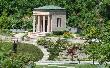
Memory Grove: Meditation ChapelThe ability to walk from downtown into the wilderness of the Wasatch is, in my opinion, the single biggest selling point of the city. This pleasant walk includes a variety of scenery with skyscrapers, church buildings, a ritzy neighborhood, public art followed by a long mountain trail that climbs into one of the most remote regions of the Wasatch Mountains. The road up City Creek Canyon is popular with hikers, joggers and cyclists. Bicycles are allowed only on odd days. Cars are allowed on even days, but I think you have to have additional permission to drive up the canyon. The lower portions of the canyon are a little bit trampled. The upper stretches are remarkably pristine.
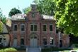
Ottinger HallWhile adding labels to the pictures, I discovered that Ottinger Hall is being rennovated by the Salt Lake Rotary as some sort of youth center. I also learned that Salt Lake will be the host of the 2007 Rotary International Convention this upcoming week. See the sites Rocky Mountain Rendezvous or Salt Lake Rotary for more information. Rotary Clubs tend to construct really cool things.

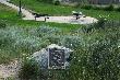
World WarAs for Memory Grove itself, I admit to being inspired by the monuments for the people who gave their lives defending this country. Monuments are important. They are both worth building and preserving. For example the World War monument was constructed in 1932 by people who may have been hoping that they would live in an era of peace, not knowing that worst things lay ahead. I was also impressed with Gold Star Hill which recognizes the pain of the Gold Star Moms who lost a child serving this nation.

Memory Grove ParkIn my book, the efforts to build parks and memorials are quiet important as they provide a valuable perspective of the events that shape the world. Above all, the monuments of the past serve as backdrops for the photos of the present.
Saturday, May 19, 2007

Parleys Crossing

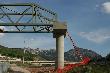
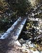
For Coco's afternoon walk, I went over to Parleys Crossing and captured a few photos of the new pedestrian bridge. This bridge will be a boon for cyclists. It will connect Parleys Hollow to the Bonneville Shoreline Trail. This will be a nice, safe green corridor into Salt Lake City.

Here are a few websites related to the project. The Bonneville Shoreline Trail is a 72 mile trail that follows the benches carved by ancient Lake Bonneville. This new bridge connects the BST to the Parleys Pratt Trail. This trail will follow Parleys Creek and eventually cut over to Sugarhouse Park.

Currently the Parleys Hollow area is a favorite destination for Utah dog owners. It will be interesting to see what happens when the new bridge brings cycling traffic into the hollow. There are many people who would love to see dogs banned from the Parleys Hollow area. Here are more trail resources for Salt Lake City. Here are a few of the pictures I took during the walk:

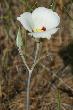
Sego LilyNew BridgeGrandeur Peak ParkMouth of Parleys

Wednesday, May 16, 2007

Lake Blanche

Shhhh! Don't tell Coco.

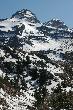
While Coco was on a trip with her owners, I took advantage of a free afternoon to hike up the Mill B South Fork Trail to Lake Blanche. The hike provides some killer views of Sundial and Dromedary Peaks. If you have a full day, you can hike to the tops of the peaks and see the other side. Being a good weboholic, I took my camera and shot photos. There's over a hundred pictures in this set that includes both wildflowers and scenic views. You can skip to the middle pages to get to the alpine scenes. The Cottonwood Ridge of the Wasatch is one of those areas that would be a national park if it were in any other state.

Wisely, the state does not allow dogs in the canyon.

The trail follows a little creek labeled Mill B. The name is a bit confusing as there is another Mill B Creek on the other side of Big Cottonwood Canyon. The literature refers to them as North and South Forks of Mill B Creek. This is even more confusing since both creeks drain directly into Big Cottonwood Creek. There are also creeks called Mill A, C and D.

The trail is relatively steep. It climbs 2700 feet in about three miles. I wore a shirt sleave shirt, no hat and no sunscreen. I was having a worse time with the high altitude sun than the steep grade. I ended up camping out in the shade of an SPF 40 pine tree to let my skin cool down. Because the air is cooler at high altitudes, people like me tend to forget that the sun is more intense.

Because I took a long siesta on the way up, I found I was pressed for time to invest walking around the lakes. I ended up walking the last mile of the trail back to the car in the dark. The tips for the trail: Bring a hat. Wear a long sleave shirt. Bring sun sreen. Don't bring a dog. Above every, be prepared to enjoy wildflowers and scenery.

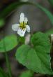
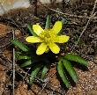
White VioletDromedary PeakAlpine buttercupReflecting on Sundial PeakSouth Fork Mill B Drainage

Wednesday, October 11, 2006

Alpine Loop

I've been having a large number of technical difficulties of late. It seems that service at companies and the quality of products sold in stores has deteriorated in the last several years. There is no need to gripe about the things that are taking up all of my time.

Little Mill Group CampgroundLast week I took a drive along the Alpine Loop to grab some shots of fall folliage. The was a storm before the day I took the pictures (my car was in the shop.) The fact that I took the shots after a storm meant that both the trees and the ground was covered with leaves. I have a small boat load of other pictures to upload which I hope to do so in the upcoming weeks. (technical difficulties permitting).

Monday, September 18, 2006

Big Cottonwood Canyon

Big Cottonwood CanyonI finished labeling the pictures I took from Big Cottonwood canyon. I had had major problems with servers last month which pretty much prevented me from labeling or making improvements on the site. I will be out taking new pictures this week. Hopefully, it won't take half a year to label the bad boys.

I would appreciate input on whether or not the galleries have too many pictures. My original idea was to take about dozen picture of a subject. A place like Big Cottonwood is filled with some many interesting subjects that I go snapshot happy. Of course, having multiple angles of a subject does provide information. Comments from people are always appreciated. (Comments from spambots are never appreciated.)

Sunday, July 23, 2006

Grandeur Peak

Church Fork Cascade
On July 21, I took a short walk up the Grandeur Peak Trail. I spent about 15 hours processing, resizing and labeling images from the walk. I need to find a better way of doing this. About three quarters of the images are of wildflowers. So, I am gradually accumulating a resource with information about what types you will find, when and where in the Rockies. Click the picture on the right and you can follow the hike (with all the wildflowers) to the summit. There's about 100 images in the gallery. I have yet to figure out the ideal number of pictures for a gallery, I figure 80 is max ... however it is easy to cross that number when including images of plants.

Sunday, July 16, 2006

Bonneville Shoreline Trail

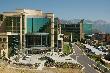
Huntsman Cancer InstituteI took a short walk along the Bonneville Shoreline Trail from Red Butte Gardens to the new Huntsman Cancer Institute building at the University of Utah Medical Center.

Wow, there is big money in medicine. The new building cost $100M to build add that to other facilities in the area and you have a price tag approaching a billion. If you are looking for a career. The place to be is health care.

This little corner of the Bonneville Shoreline Trail provides beautiful vistas of the University and Salt Lake City. You can cap off a trip with a visit to Red Butte Gardens which provides horticulture displays.

This section of trail is a good example of my ideals of urban development. You have a complex with multiunit housing, large buildings, etc., next to wilderness.

It is much better than the sprawl paradigm where the town sprawls out from the center.

Monday, May 22, 2006

Bowman Fork Trail

Here is a pile of photos from the Bowman Fork Trail in the Wasatch Mountains. The hike was cut short by a rain shower. My new camera takes decent pictures of wildflowers. I will start filling up Protophoto.com with flowers.

I admit it would be tempting to start making a guide to flowers (that is including Genus and species info with the pictures). The problem here is that I am pretty much clueless on botany. I haven't a clue about the little flower to the right. The clueless shouldn't make guides.

Friday, May 19, 2006

Mill B Trail

Here are some pictures of the Mill B Trail in Big Cottonwood Canyon.

I was just reading an article that talked about how having a dog makes people more active. The odd thing with me is the opposite is true. I used to take really long bike rides and do all day hikes. Being charged with a small chocolate lab I find that the foolish dog dominates my recreational life. The dog demands multiple short walks each day. The really bad part of having a dog is that the dog dictates where I go. I've been wanting to visit the Cottonwood Canyons, but dogs aren't allowed in the canyon. For that matter, I ended up cutting my walk through Mill B canyon short because I had to get home to take the dog on a walk.

Sunday, April 30, 2006

Desolation Trail


Desolation Trail
I took Coco on a short walk up the Desolation Trail. Since I have to take Coco on regular walks, I never do long walks ... just short walks in areas that allow dogs. There was still a little bit of snow on the trail. A large number of trees seem to have fallen down this winter. I decided that more trees are falling down than normal because George Bush is in the White House.

I am actually a little bit concerned about the trees in Mill Creek. I recall the forest being denser in years. I think the area was hit hard with diseases in the last several decades. The canyon had a gypsy moth infestation in 1993. I think the forest suffered a few other blights along with extremely heavy usage from humans in the last years.

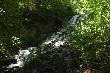
The little brook at Church Fork was running at full force; so I decided to take picture of it as well.

Monday, January 30, 2006

Devils Garden Trail

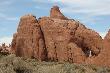
I took this set of images on the Devils Garden Trail in Arches National Park during October. I think this is best trail to take first time visitors to the mountain west. The trail winds through stunning fins of Entrada Sandstone with an arch around every corner. The trail has a good combination of easy walking with enough ups and downs to test the desert new comer.

I took this set of pictures with my new camera. The orinals of each of these shots is in 1 megapixel mode. These end images are about tenth the oringal size.

Sadly, it takes more time to process the friggin' pictures than it does to take the pictures. My new camera is much better than my old camera.

Friday, June 24, 2005

Lost Collar

I took CoCo to the Parley's Hollow unofficial off leash area yesterday.

She was doing a pretty good job not running ahead. We we were about 4/5th of the way to the culvert, she ran ahead. Uncharacteristically, she did not come back when I called. I called for about 4 minutes, and she came back ... without her collar.

So, now I have a strange mystery. What happened to her in those minutes that caused her to lose her collar. Did she get in a tussle with another dog? Did she meet a human that took her collar? Did she crawl under a bush and get the collar snarled in a branch? Does she know some secret collar escape trick, and waited for the opportunity to escape?

I looked for about twenty minutes for the collar but could not find it.

Fortunately, I still have the bright purple collar that you see in the picture to the right. I am not sure if I will have to replace the rabies shot tag.